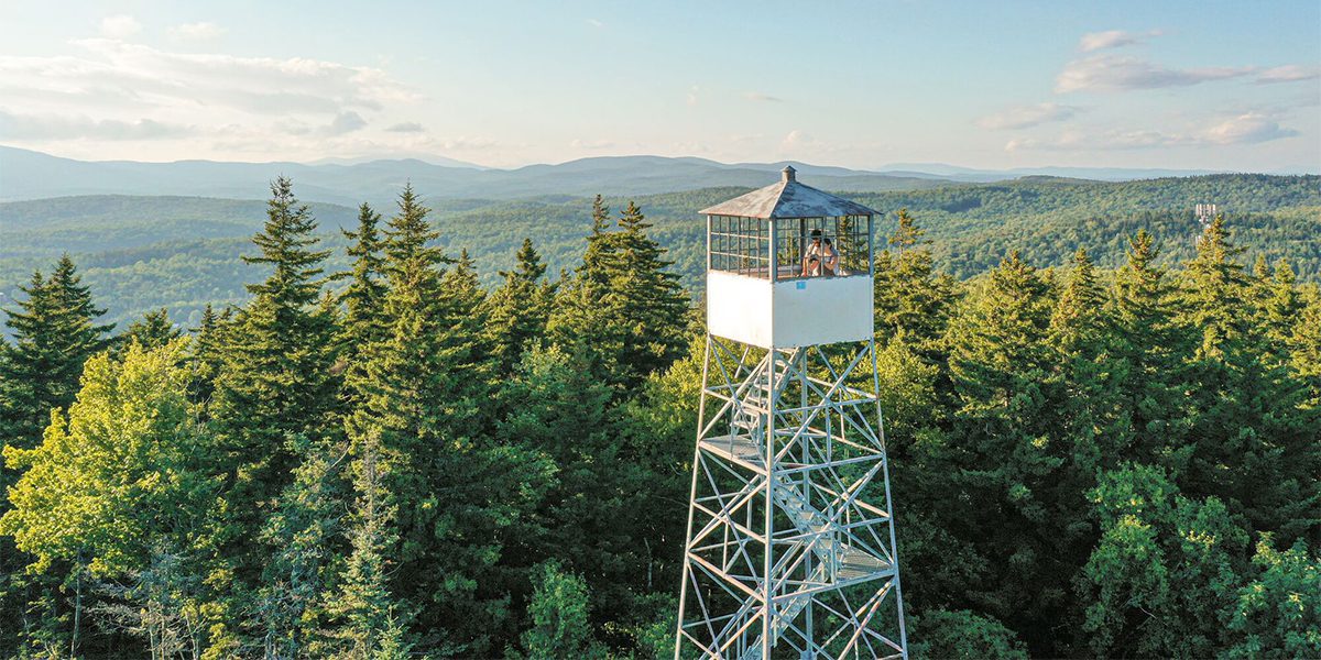
14 Fire Towers to Climb in Vermont
Vermont’s fire towers were purpose-built in the early 1900s to keep watch for forest fires. Deforestation in the late 1800s led to a lot of dry wood in Vermont’s forests, and in the early 1900s, a series of wildfires burned more than 15,000 acres across the state.
In 1904, the state of Vermont established a fire safety program. A few years later, the state hired the first-ever fire warden. He advocated for a system of fire towers, and wealthy landowners financed their construction to better protect their land.
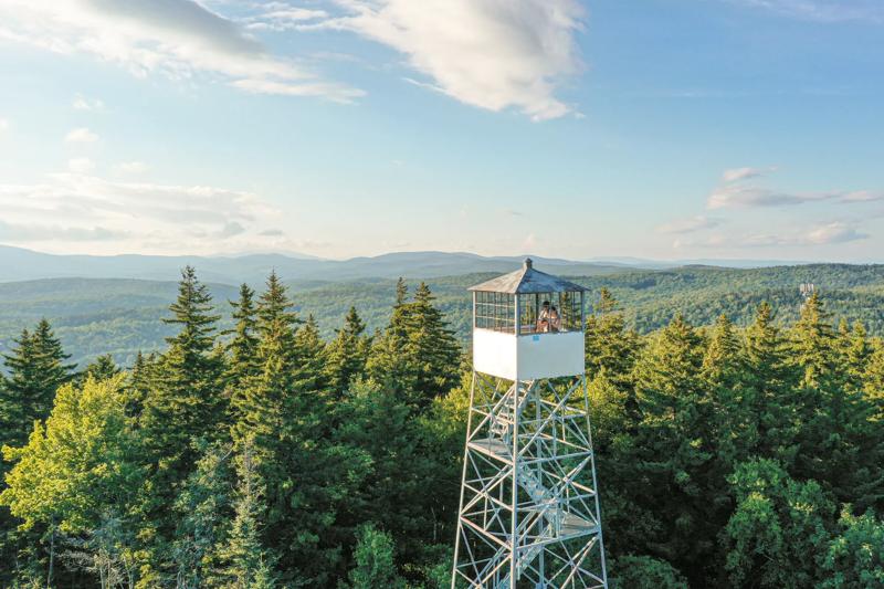
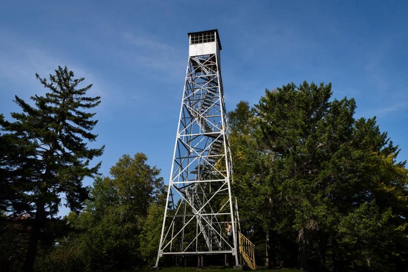
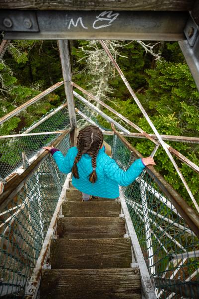
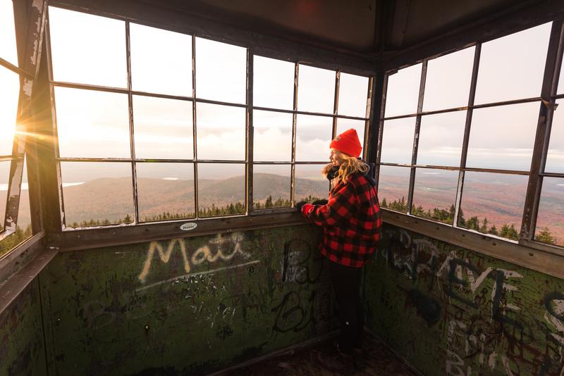
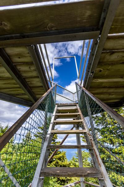
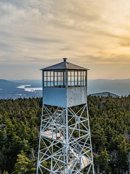
The fire towers were often made of metal with four or five flights of wooden stairs wrapping around the tower and leading to the top. Lookouts were paid $2 a day to stand watch.
Vermont was once home to 38 of these historic structures. Today, 14 remain open and accessible to hikers, offering a birds-eye view of the sweeping landscape and the feeling of being in a treehouse. Many towers are also accessible to those who would prefer to drive to the mountain’s peak.
Want to see views from above the treeline? Visiting from late May through October gives you your best shot at climbing the tower when it is open. It’s a good idea to wear closed-toe shoes, keep three points of contact as you climb the stairs, which can be narrow and steep, and remember conditions at the top can be windier than at the bottom.
Mt. Olga Fire Tower
Elevation: 2,415 feet
Location: Molly Stark State Park, Wilmington, Vermont
This picturesque tower, moved here from Townshend State Park in 1955, rises about 50 feet above the summit of Mt. Olga. Part of Molly Stark State Park in Vermont’s Deerfield Valley region, the tower is accessible via the Mt. Olga Trail, about 1.7 miles. Take in vistas of Hogback Mountain Conservation Area, Mount Snow, the Deerfield Valley, and the Green Mountain National Forest. Parking is available at the park.
Burke Fire Tower
Elevation: ~3,220 feet
Location: Burke Mountain, Burke, Vermont
Vermont’s first fire tower offers panoramic, 360-degree views from the top of Burke Mountain of Vermont’s Northeast Kingdom region. In 1935, a Civilian Conservation Corps (CCC) crew completed the auto road to the summit. Today, the 3-mile paved toll road can be accessed by driving through Burke Mountain Campground. From the summit parking lot, visitors can hike the Summit Trail to reach the fire tower. There is also a .03-mile universal access trail from the parking that offers a great view. For a full hike to the fire tower, visitors can use the parking lot on Sherburne Lodge Road off Mountain Road.
Bear Hill Fire Tower
Elevation: 2,030 feet
Location: Allis State Park, Brookfield, Vermont
Access this central Vermont tower by driving up the summit road to the base or hiking the Bear Hill Nature Trail to the top, about a one-mile loop through a forest. On a clear day, Killington, Pico, and Mt. Ascutney peaks are visible to the south, Camel’s Hump and Mt. Mansfield to the north, Abraham, Lincoln, and Ellen to the west, and the White Mountains of New Hampshire to the east.
Mount Elmore Fire Tower
Elevation: 2,650 feet
Location: Elmore State Park, Elmore, Vermont
Park at Elmore State Park and hike about 1.75 miles up the Fire Tower Trail or the longer Ridge Trail to be rewarded with sweeping views of Vermont’s Lamoille Valley, Madonna Mountain, and Mount Mansfield to the west and the Presidential Range in New Hampshire to the east.
Okemo Fire Tower
Elevation: 3,343 feet
Location: Okemo State Forest, Ludlow, Vermont
Access this southern Vermont lookout by driving to the top on the seasonal Okemo Mountain Road located off Vermont Route 100 and past Okemo Mountain Resort’s Clock Tower Base Lodge. Visitors can also hike the 6-mile round-trip Healdville Trail from a parking lot on State Forest Road in Mount Holly. Views from Vermont’s tallest fire tower include the Taconic Range in the west and southwest, Mt. Ascutney and points in New Hampshire to the east, and Killington to the north.
Bolton Fire Tower
Elevation: 3,150 feet
Location: Bolton, Vermont
Climb Vista Lookout Tower Trail at Bolton Valley Resort to take in the view from the top of this tower, including Camel’s Hump to the south and Mount Mansfield to the north, both over 4,000 feet high. The Worcester Range is visible to the east. Parking is available at Bolton Valley Resort near the main base lodge.
Hubbard Park Observation Tower
Elevation: 850 feet
Location: Montpelier, Vermont
Hike the Stone Tower Path to reach this stone observation tower in the heart of Vermont’s capital. From the top, take in views of the golden dome at the Vermont State House and the city cradled in the Winooski River Valley. Parking is available behind the Vermont State House or near the intersection of Parkside and Hubbard Park drives.
Spruce Mountain Fire Tower
Elevation: 3,0037 feet
Location: Plainfield, Vermont
Located within the L.R. Jones State Forest, this tower offers a vantage point to see Camel’s Hump, the Worcester Range, Mount Mansfield, and the White Mountains in New Hampshire. The trailhead is located at the end of Spruce Mountain Road in Plainfield, where parking is available, and follows a logging route to the top, becoming steeper and rockier as you hike for just over 2 miles.
Bald Mountain Fire Tower
Elevation: 3,315 feet
Location: Westmore, Vermont
One of the few remaining sites where both the tower and its associated lookout cabin still stand, hikers can take in views of Vermont’s Northeast Kingdom from the top of the tower, including the famed vista at Lake Willoughby. The Mad Brook or Long Pond trails are both good choices to access the tower. Both trailheads have small gravel parking lots that can fill on busy days. Both trails offer a moderate, about 2-mile hike through subalpine spruce-fir forests before a short but steep climb to the top of Bald Mountain.
Owl’s Head Fire Tower
Elevation: 1,952 feet
Location: Groton State Forest, Peacham, Vermont
Unlike some other fire towers in Vermont, this 1935 construction was built from stone. Take in the sights, including views of Kettle Pond, the Green Mountains, and Camel’s Hump, after a moderate, approximately 2-mile hike with a relatively small elevation gain. Visitors can also drive to the upper picnic area and walk about a quarter-mile to the tower. Parking is available at Groton State Forest.
Ascutney Fire Tower
Elevation: 3,144 feet
Location: Windsor, Vermont
From the top of the 25-foot-tall observation tower, take in views of the Connecticut River Valley, Vermont’s Green Mountains, and New Hampshire’s White Mountains, with Mount Washington visible on a clear day. Visitors can drive up the summit road located at Mount Ascutney State Park and hike about 0.7 miles to the fire tower, or within the state park, the Windsor or Brownsville trails are recommended to access the fire tower. The Slab Trail is typically used for the final ascent. Parking is available at the state park.
Gile Mountain Fire Tower
Elevation: 1,873 feet
Location: Norwich, Vermont
Vermont’s Upper Valley is on full display from the top of this fire tower, with 360-degree views above the treeline of Mount Ascutney, Killington, and Camel’s Hump. Park at the small gravel parking lot on Turnpike Road; it is prohibited to park on the side of the road. A moderate, 1.6-mile hike leads to the summit and the tower.
Stratton Mountain Fire Tower
Elevation: 3,940 feet
Location: Stratton, Vermont
At 55 feet, this fire tower is among the tallest in Vermont. Hikers are rewarded with panoramic views of four states and four major mountain ranges: the Greens in Vermont, the Whites in New Hampshire, the Adirondacks in New York, and the Berkshires in Massachusetts. The view is often cited as the inspiration for the construction of the Long Trail, the oldest long-distance through-hiking trail in the U.S. Access it either by an approximately 8-mile hike to the summit or by taking the gondola at Stratton Mountain Resort followed by a .75-mile hike to the tower’s base. Parking is available at Stratton Mountain Resort.
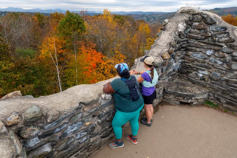
Prospect Hill Observation Tower
Elevation: 1,375 feet
Location: Brownington, Vermont
Brownington’s Old Stone House Museum celebrates the life of Alexander Twilight, the first Black person to receive a college degree in the U.S. On its side is the Prospect Hill Observation Tower, a two-story observatory built in 1989 offering expansive views of the Northeast Kingdom. Parking is available at the museum.