Vermont Scenic Byways
Take the Scenic Route
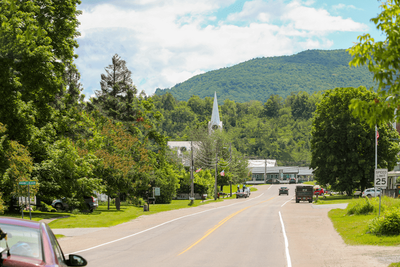
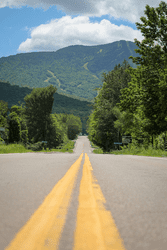
Driving a Scenic Byway
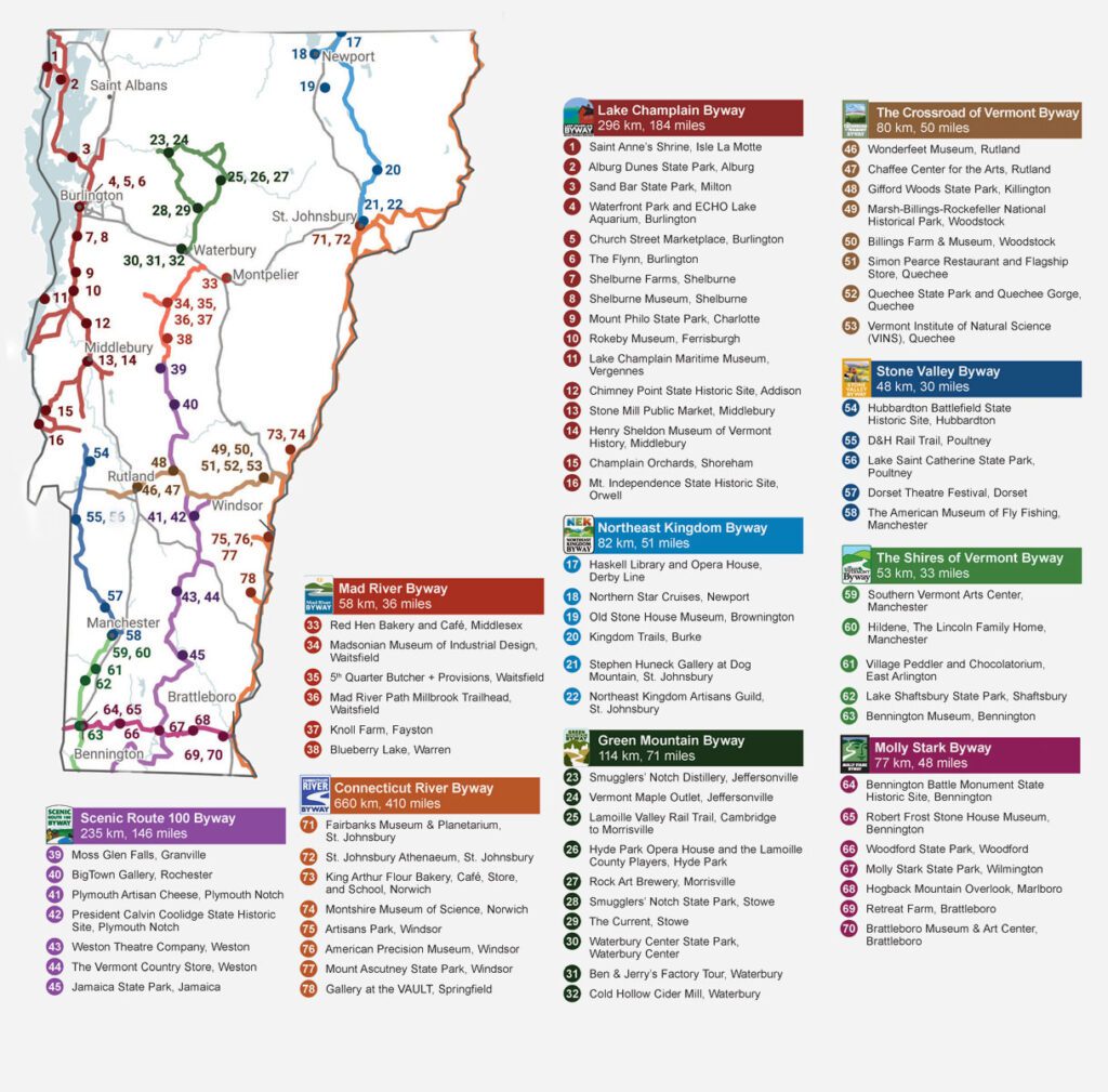
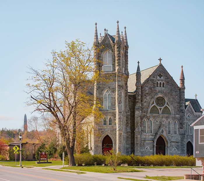
Ten federally designated scenic byways wind through the Green Mountain State, meandering through mountains and meeting in valleys. Colorful routes connect historic downtowns and farms. Vermont’s scenic routes range in length from 30 miles to 410; tour by car, motorcycle, or bicycle to discover trailheads, waterfalls, museums, boutiques, and more.
Order a free printed map here.


Connecticut River Byway
Carved between the Green Mountains of Vermont and the White Mountains of New Hampshire is 410 miles of the historic Connecticut River and the Connecticut River Byway, Vermont’s only designated national byway.
Learn More about Connecticut River Byway
Crossroad of Vermont Byway
This 50-mile east-west route spans the state from Rutland to the New Hampshire border, including Woodstock and Killington.
Green Mountain Byway
The Green Mountain Byway travels routes 100, 108, and 15, visiting the quaint and vibrant towns of Waterbury, Stowe, Morristown, Hyde Park, Johnson and Cambridge. Traveling along the Byway provides stunning views of open meadows, farmland and forests, all with a spectacular mountain backdrop.
Learn More about Green Mountain Byway
Lake Champlain Byway
Following the northern length of Lake Champlain for 184 miles south from the Canadian border, the Lake Champlain Byway offers spectacular scenery. The Champlain Islands, including the lakeside communities in Grand Isle County, are home to Vermont’s own fossil reef.
Learn More about Lake Champlain Byway
Mad River Byway
The Mad River Byway’s 36 miles follow Route 100 and Route 100B to join communities including Waitsfield and Warren, offering beautiful views and local dining and shopping.
Learn More about Mad River Byway
Molly Stark Byway
Vermont’s southern-most byway winds its way through lowland valleys Green Mountain National Forest, linking historic towns like Woodford, Vermont’s highest settled town, and Brattleboro.
Learn More about Molly Stark Byway
Northeast Kingdom Byway
The Northeast Kingdom Byway’s 51 miles include St. Johnsbury, Lyndon, East and West Burke, and Newport, offering endless recreational opportunities throughout the seasons, quintessential Vermont villages resplendent with classic architecture, and a rich diversity of art, unique shops, entertainment, and events all year long.
Learn More about Northeast Kingdom Byway
Scenic Route 100 Byway
Also known as “Vermont’s Main Street” and “The Skier’s Highway,” Route 100’s 146 miles connects some of the best Northeastern skiing and riding, including Stowe and Waterbury and running all the way down to West Dover.
The Shires of Vermont Byway
Anchored by Bennington, the South Shire, and Manchester, the North Shire, 15 Vermont towns and villages are connected by the 33-mile scenic ribbon of highway known as Historic Route 7A. Surrounded by mountains and enriched by the waters of the famous Batten Kill River that runs through the valley, beautiful views abound.
Learn More about The Shires of Vermont Byway
Stone Valley Byway
Many of Vermont’s southern communities are set in stone. The Stone Valley Byway celebrates that history, leading to acclaimed theater at the Dorset Playhouse, a Revolutionary War battlefield historic site and the museums operated by the Poultney Historical Society.
Each Region is a New Experience
The Regions of Vermont
For such a small state, Vermont is home to lots of variety. In the Champlain Islands up north, colorful art adorns public spaces and beaches abound. In northern Vermont, the Greater Burlington region is home to Vermont’s biggest city and the Northeast Kingdom is its most rural region. In the Champlain Valley, swaths of open farmland wrap around mountains with trailheads beckoning. In the southern parts of the state, such as the Lower Champlain Valley, Shires, and Deerfield Valley regions, storied downtowns and a rich history including Americana folk art, stone quarrying, and more offer plenty to discover. Connecting all 14 Vermont regions are the 10 federally designated scenic byways.
Trip Planning is Easier with a Guide
Start planning for a memorable Vermont vacation with a free planning packet, including a road map (perfect for your glove box), an inspiration guide featuring some of the best things to do in the Green Mountain State, and information on scenic byways, food and farms, state parks, and more.
Order Your Guide about Trip Planning is Easier with a Guide